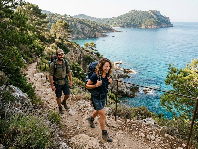
The coastal path (sentier du littoral) follows the sea closely from Saint-Tropez to the Bouches-du-Rhône border. Marked GR, mostly accessible to all, it offers belvédères, hidden creeks, swim breaks at every cove. The Var section is around 200 km in total, divided into many shorter hikes.
Best Var sections: Cap Lardier (Cavalaire to Gigaro, 3-5h, easy-medium, swims at the end), Cap Taillat (Pampelonne to L'Escalet, 2h one way), Pampelonne to Cap Camarat (1h30, beach + coastal trail), Cap Nègre (Cabasson to L'Estagnol, 1h30, family-friendly).
Each hike combines spectacular views, easy walking, and the freedom to swim along the way. Start early (before 8am in summer to avoid heat), bring 1.5L water minimum per person, sun cream, swim shoes (some passages are pebbly).
Top Var coastal hikes
By section and difficulty:
- Cap Lardier (Gigaro to Cap Lardier, 3-5h, easy-medium): 13 km loop. Wild peninsula, multiple coves, possible swim at Sylvabelle. The most iconic Var hike.
- Cap Taillat (Pampelonne to L'Escalet, 2h one way, easy): 5 km. Pampelonne sand, then rocky coast, end at L'Escalet cove. Possible to return by bus or shuttle.
- Pampelonne to Cap Camarat (1h30, easy): 4 km. The most accessible. Family-friendly.
- Cap Nègre (Cabasson to L'Estagnol, 1h30, easy): 3 km. Wild coast, presidential summer house in the distance (Fort de Brégançon).
- Cap Bénat (Cabasson loop, 2h30): 6 km. Less crowded, similar to Cap Nègre.
- Esterel coast (Anthéor to La Figueirette, 2h, medium): 5 km. Red rocks of the Esterel massif.
- Sentier des Douaniers (Cogolin to La Madrague, 1h, easy): 2.5 km. Historic customs path.
Practical: when, what to bring
For a successful hike:
- Best season: spring (April-June) for flowering mimosas and almonds. September-October for warm water and pleasant temperatures.
- Start time: 7-9am in summer to avoid heat. 9-11am off-season.
- Water: 1.5L per person for 2h, 2-3L for longer hikes. No fountains along the path.
- Sun cream, hat, sunglasses, swimwear (always pack — you'll want to dip).
- Closed walking shoes or hiking sandals. Avoid flip-flops.
- Snack: fruit, energy bars, dried fruits.
- Cell phone with GPS in airplane mode (signal limited in some sections).
Swim spots along the way
The best dips:
- Sylvabelle (Cap Lardier): hidden cove, fine sand, accessible only by the path. Magical.
- Cap Taillat: cove at the foot of the path, accessible after 30 min walk from Pampelonne.
- Plage de Gigaro: end of the Cap Lardier hike. Family-friendly.
- L'Escalet: end of the Cap Taillat hike. Charming small fishing port.
- Cap Camarat: rocky coves, snorkeling.
- Brouis (Cap Nègre): small wild cove.
Beware of sea urchins on rocky areas — wear water shoes when entering and exiting the sea.
Guided hikes and combinations
For added value:
- Guided hike with a local naturalist: €30-60 per person. Explanations of flora-fauna, history, geology.
- Photo-hike with a photographer: €80-150 for 2-3h, capture your group along the panoramic spots.
- Hike + boat pickup: walk the path, our boat picks you up at the end for the return. Romantic touch.
- Hike + lunch at a beach club: half-day walk + lunch at the end. €120-180 per person all-in.
Frequently asked questions
Is it accessible to all?
Mostly yes — flat sections with no real elevation. A few short steep zones. Children from 7-8 years old depending on the section.
Best season?
Spring (April-June) for flowering mimosas and almonds. September-October for warm water and pleasant temperatures. Summer: very hot, start before 8am.
Where to swim along the way?
Many creeks invite swimming. Some are accessible only by the path — that's part of the charm. Always check water depth before jumping.
Can we eat along the way?
Few options. Bring a picnic. In summer, beach clubs at the start/end of the hike (Cap Lardier - Gigaro for example).
Do we need a guide?
No for marked trails. Yes for cultural deepening (a local naturalist), or for off-the-marked-trail walks (e.g. the wild south of Cap Lardier).